Temperatures were rising day by day. Nights were still mostly below zero, but the strong sun warmed up the Big bag, El Bolson, between two mountain ranges often to temperatures above 20 celsius. Spring was finally coming and the warmth of the sun on my pale white skin felt fantastic. After more than a month of fishing, eating good food and enjoying local ales, I was more than ready to be back on the road again.
Numerous cyclists had told me that there is only one way to get north. Along the busy and dangerous road connecting the tourism centrals of El Bolsón and Bariloche, so for long I had thought there is nothing interesting cycling-wise in the otherwise spectacular region. A couple of weeks before my departure, though, I again started to swipe through satellite pictures through the region to find out what it has to offer.
South Argentinian Patagonia is mostly arid and windy steppe and the green Cordillera de los Andes is mostly on the Chilean side of the border. Here in the north Patagonia though, the mountain range gets wider and the line of 2000m high peaks stretches to Argentinian land as well. After a couple of days of drawing GPX tracks on pixelated satellite pictures I had a route, which seemed to be combining the best of the both worlds seen from space.
Being normally all the time on the move, seeing new places and people every day, I greatly enjoyed my two month stop in El Bolsón. I made friends and learned to know the town and the nature around it. The need of an adventure though was pulling me back into the wild. I loaded my bike with food for a couple of days and bought some new flies from a local fishing shop. Ready for anything (read: ready for doing the same as I have been doing since 2014) I got on the bike. The green valleys of El Bolson quickly turned into brown and grey steppe when I rode east over the low Cordillera. After a couple of hours on the bike I stopped at small river to cook a pot of pasta and brew a cup of coffee with my new alcohol stove. I reached the small town of El Maitén early and bought a bag a sweet pastries and two beers before continuing out of town to look for a campsite.
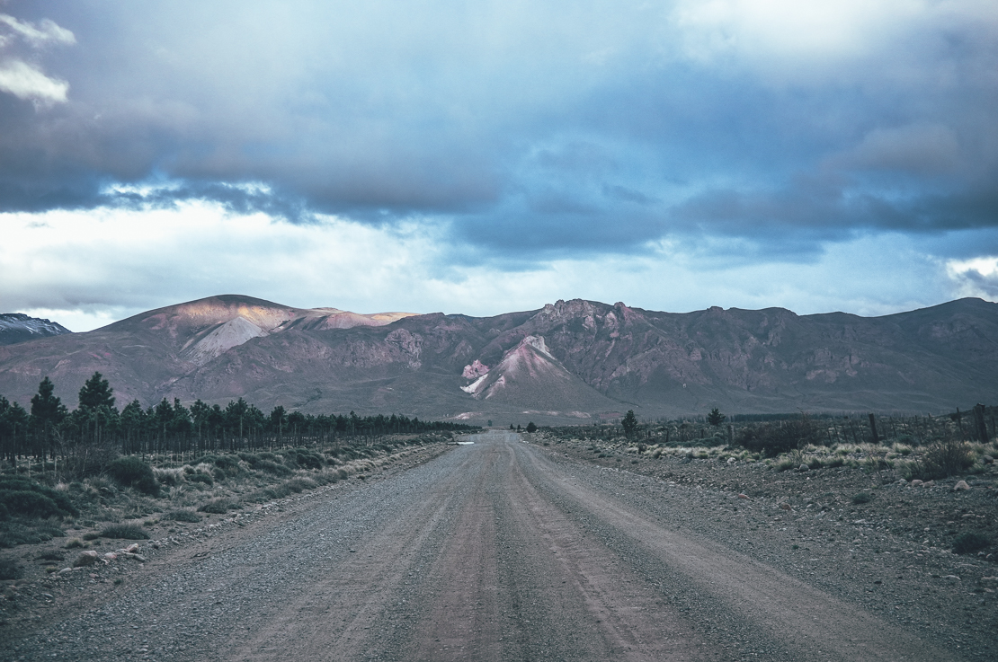
Approaching El Maitén. The green of El Bolsón was no more.
As I had assumed, the steppe was much windier than the valleys in the cordillera. I was happy that I had camped the first night in a small pine wood plantation close to the town, instead of continuing to the treeless wilderness. Road was in relatively good condition and flat though, so I was able to put in solid 13 kilometers per hours against the wind.
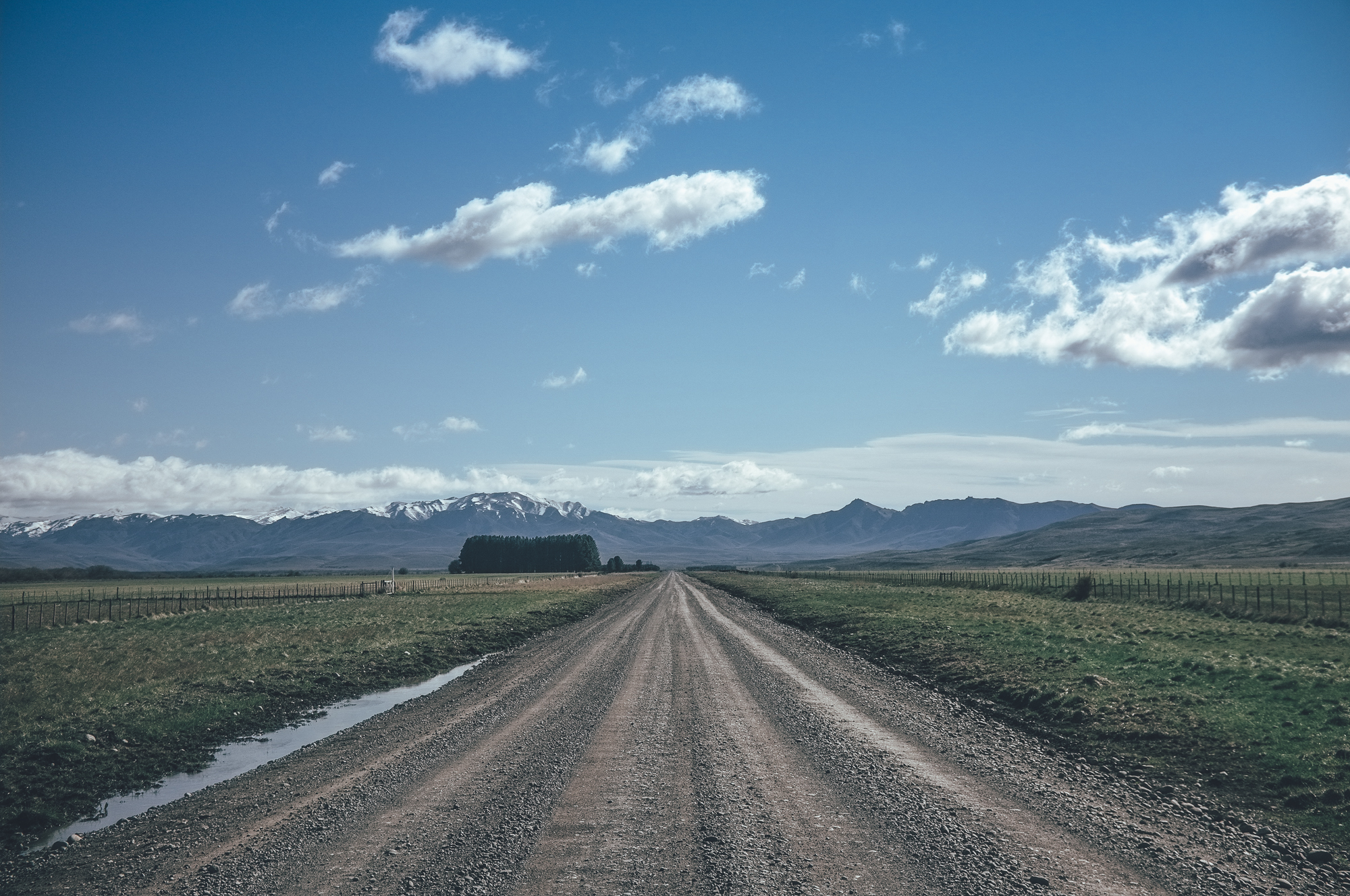
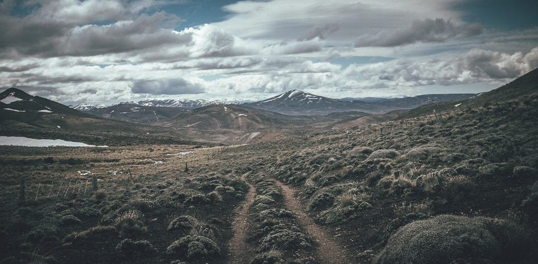
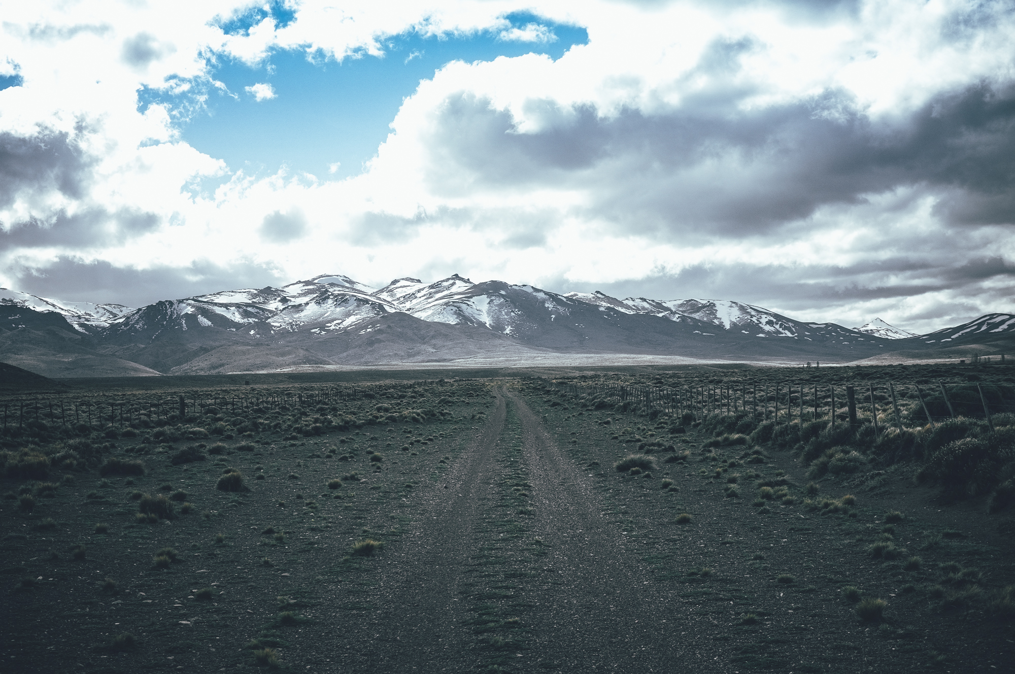
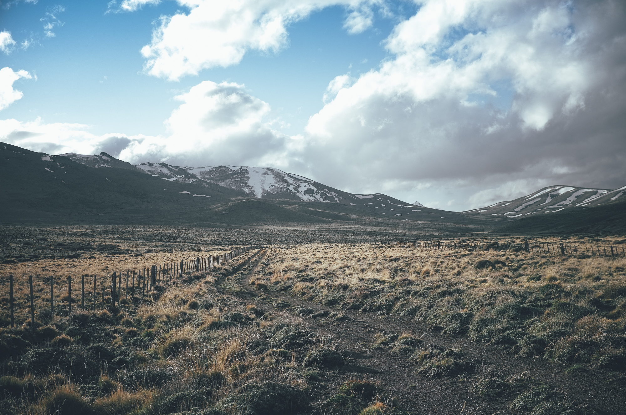
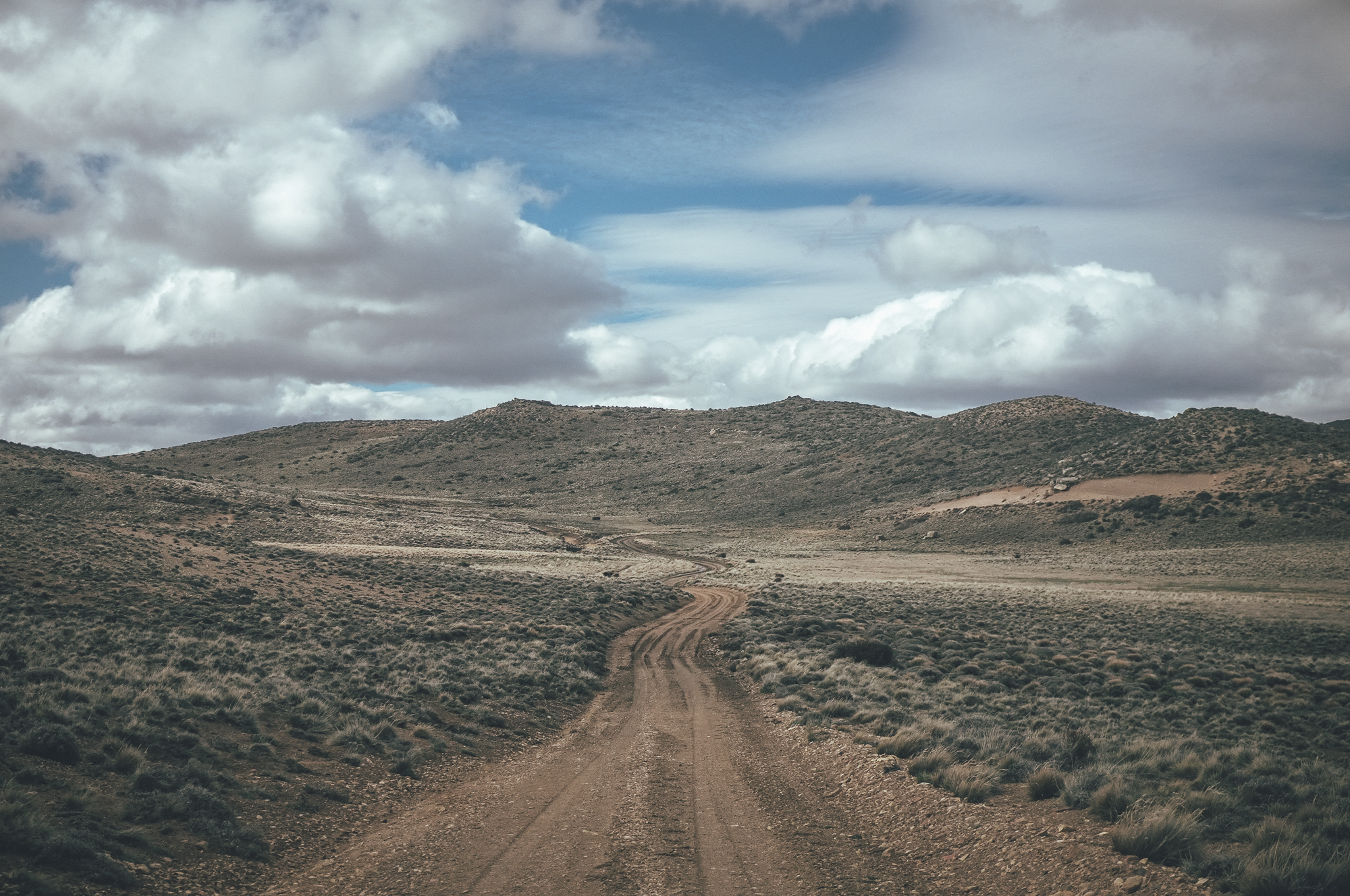
Heading north on the steppe on the ‘main road’ before heading back into the mountains.
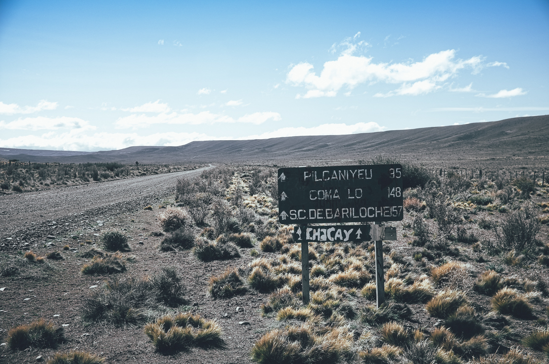
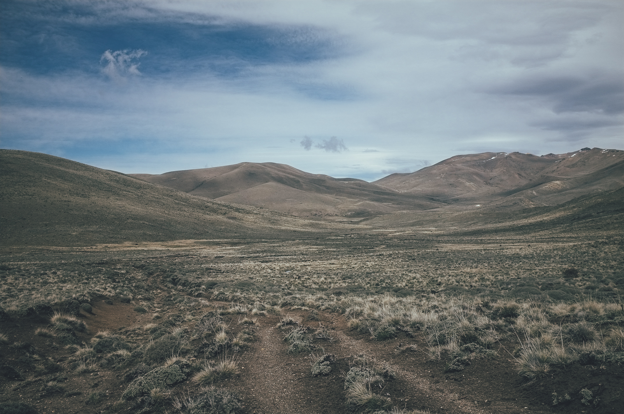
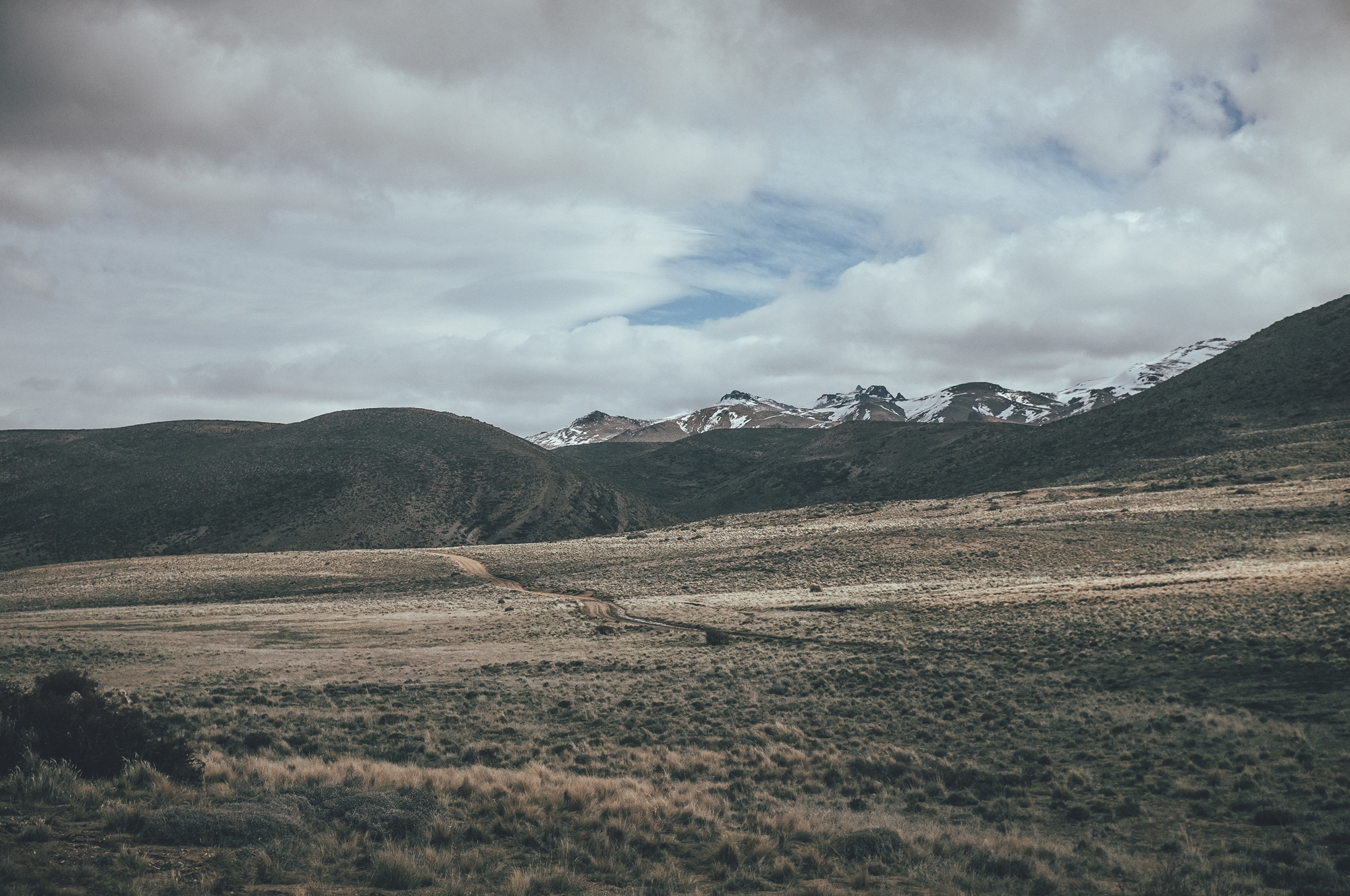
After having a lunch and stocking up for four days in the village of Ñorquinco I turned north to the double track I had found on satellite pictures. The peaks were still covered by snow, compared to the peaks of El Bolson which were already snowless. I would have ahead of me two 1480m passes, which would be likely to have some snow as well. If I had tried this route any earlier the snow would have stopped me for sure.
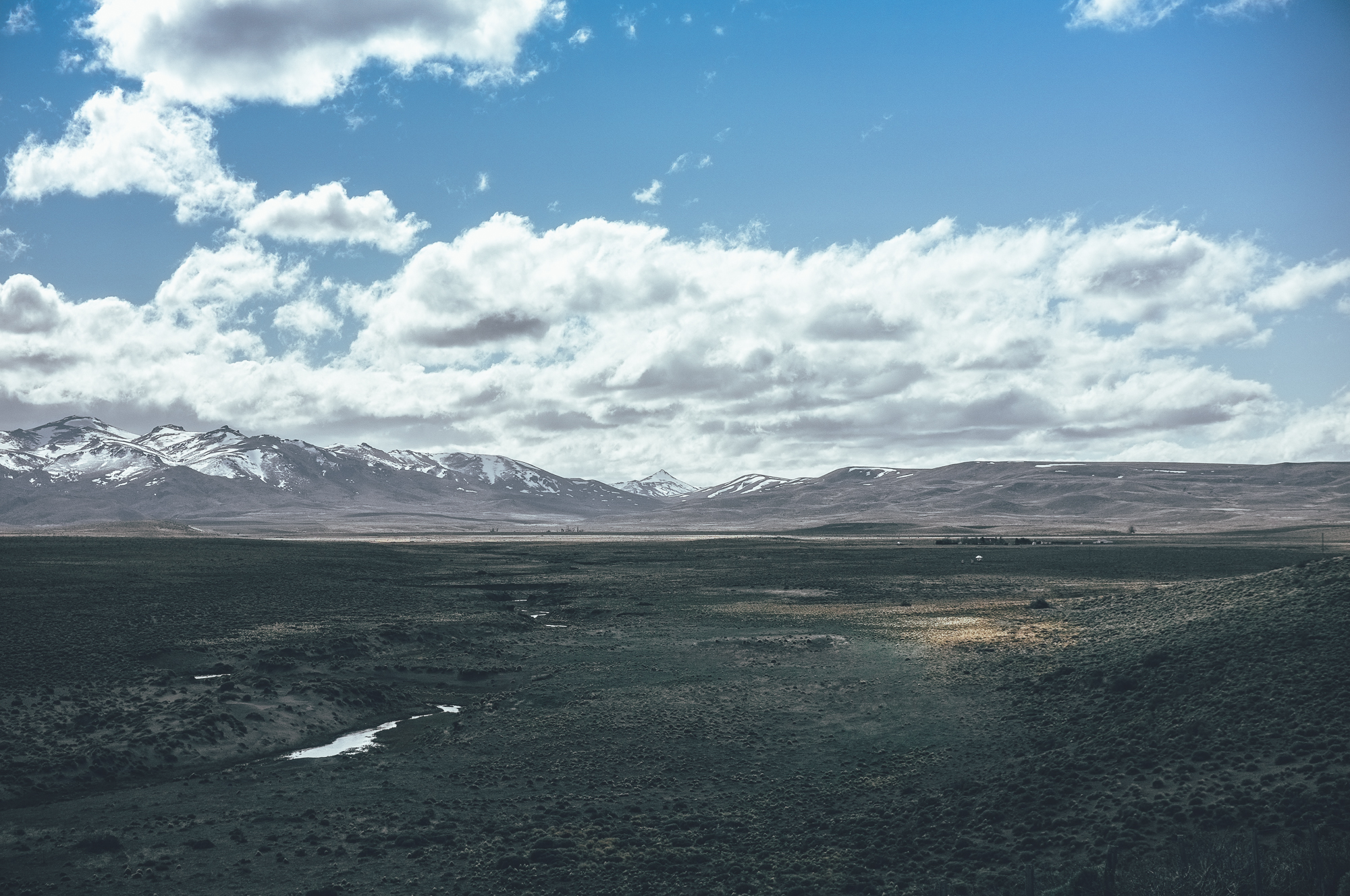
Snowline was just high enough so I was able to get over the passes.
Argentinian government had an unexplainable hatred towards the Patagonian natives, especially Mapuches, in the end of the 19th century. British helped the government financially in these raids, which resulted in something we call a genocide now. Mapuches, who had been inhabiting Patagonia since 11.000 BCE by some estimates, were systematically killed by the Argentinians, who thought the land would be rightfully theirs. Long story short, Argentinian government thanked the Brits by donating 2.5 million acres of claimed land to Brits. (Read more about the oppression of Mapuche people here.)
The Patagonian steppe was somewhat ideal grazing ground for cattle so the remote lands were habited by farmers imported across the pond. Distances from the estancias to the nearest port were occasionally thousands of kilometers, so the practical Brits built a railway line, Old Patagonian Express aka La Trochita in the early 20th century to collect the ready-to-be-slaughtered animals to the coast, where they would be shipped to the Europe. Remnants of the age are clearly visible in the Central and Northern Patagonia and a gravel grinder will cross this far forgotten railway line multiple times on the steppe on the way north. My route from El Bolsón happened to pass a remote railway station and I greatly enjoyed the wind cover that the forgotten train cars provided me, despite the bloody history of this dashed line on my map.
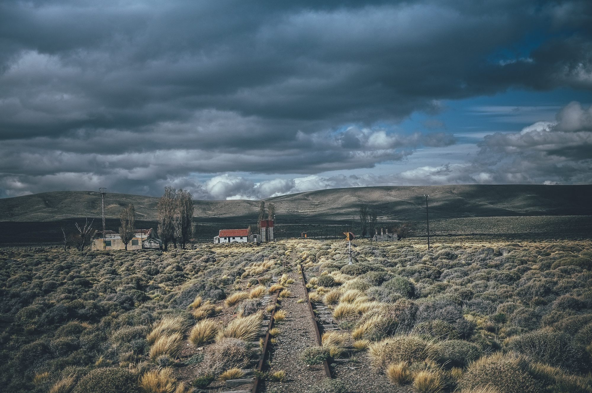
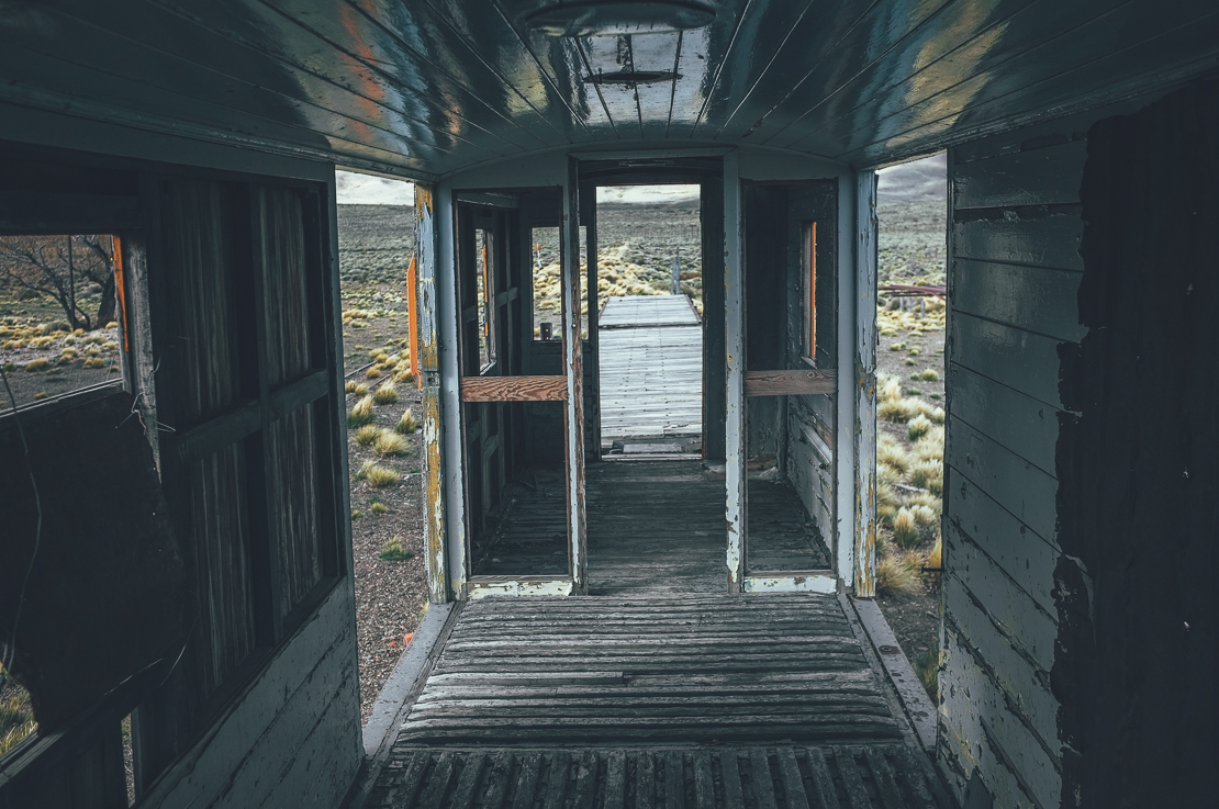
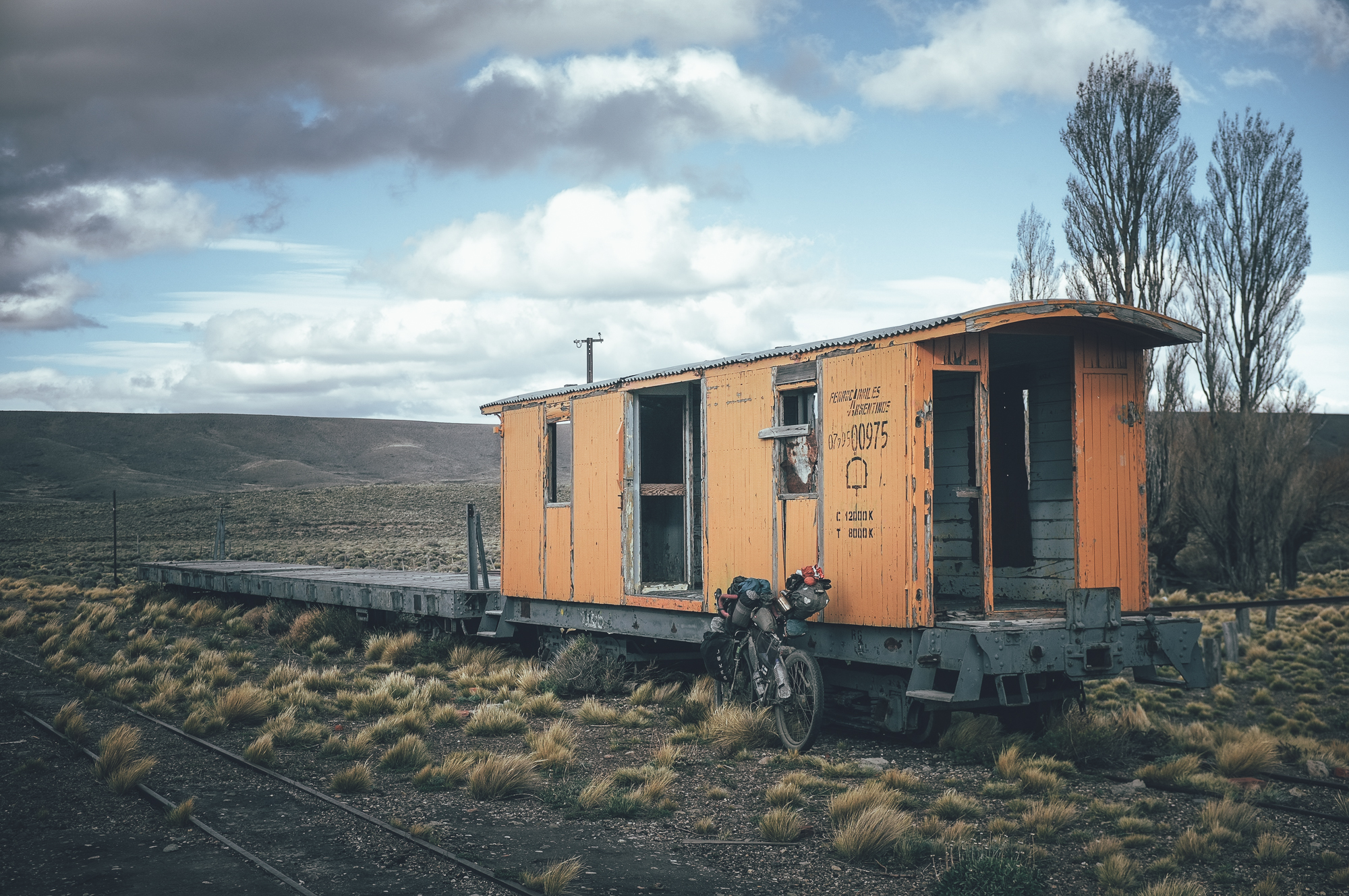
A remote station of La Trochita aka Viejo Espresso Patagónico aka Old Patagonian Express in the Andean foothills.
The climb to the first 1480m pass was soft, but mostly rideable double track. There was snow in white patches on the pass, but nearly not at all on the road. My timing to attempt the route had been spot on. I descended from the pass to a river after sunset navigating the technical gravel road with the help of my dynamo powered front light. I crossed the freezing cold knee-deep river in moon light and camped behind some thorn bushes for wind protection. When I retreated to the warmth of my sleeping bag a thin layer of snow had illuminated the valley in the moonlight. I knew I should have felt a little scared of getting stuck in the valley if the snowfall at night would grow any stronger, but what could I do about it? I slept like a baby and faced the world again in the morning to find out there were only 5cm of thin snow on the ground. El Bolson is only 3000km from the equator, which in the spring means the sun rises very high on the sky. When I crowld out of my tent a couple of hours after the sunrise most of the snow had already melted. I drank my morning coffee on the river bank, watching trout swimming from pool to pool and occasionally rising to eat a fly on the surface. As much as I love fishing, I did not feel like disturbing the life of these beautiful creatures by luring them in my hands by hairy food imitations.
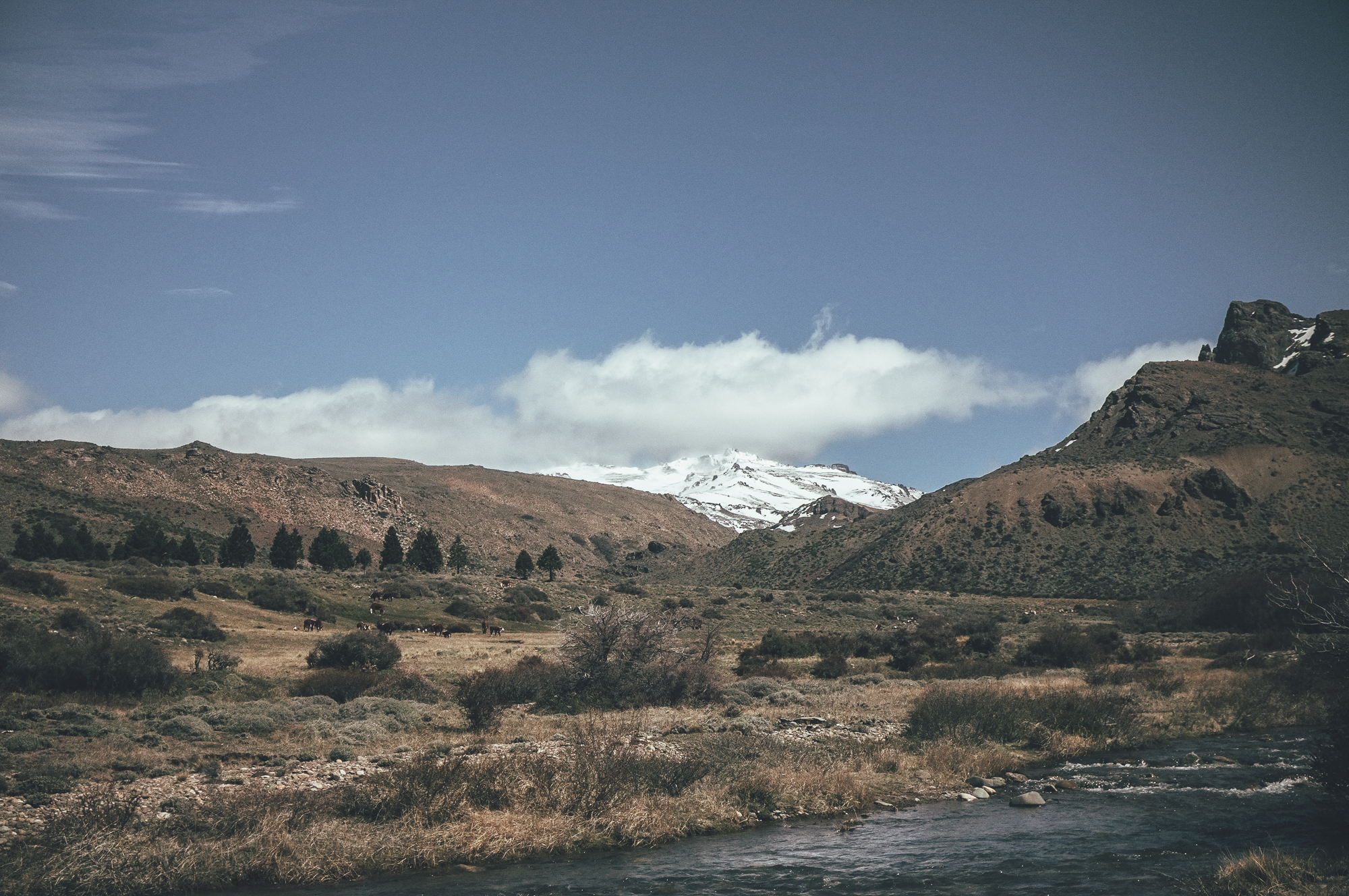
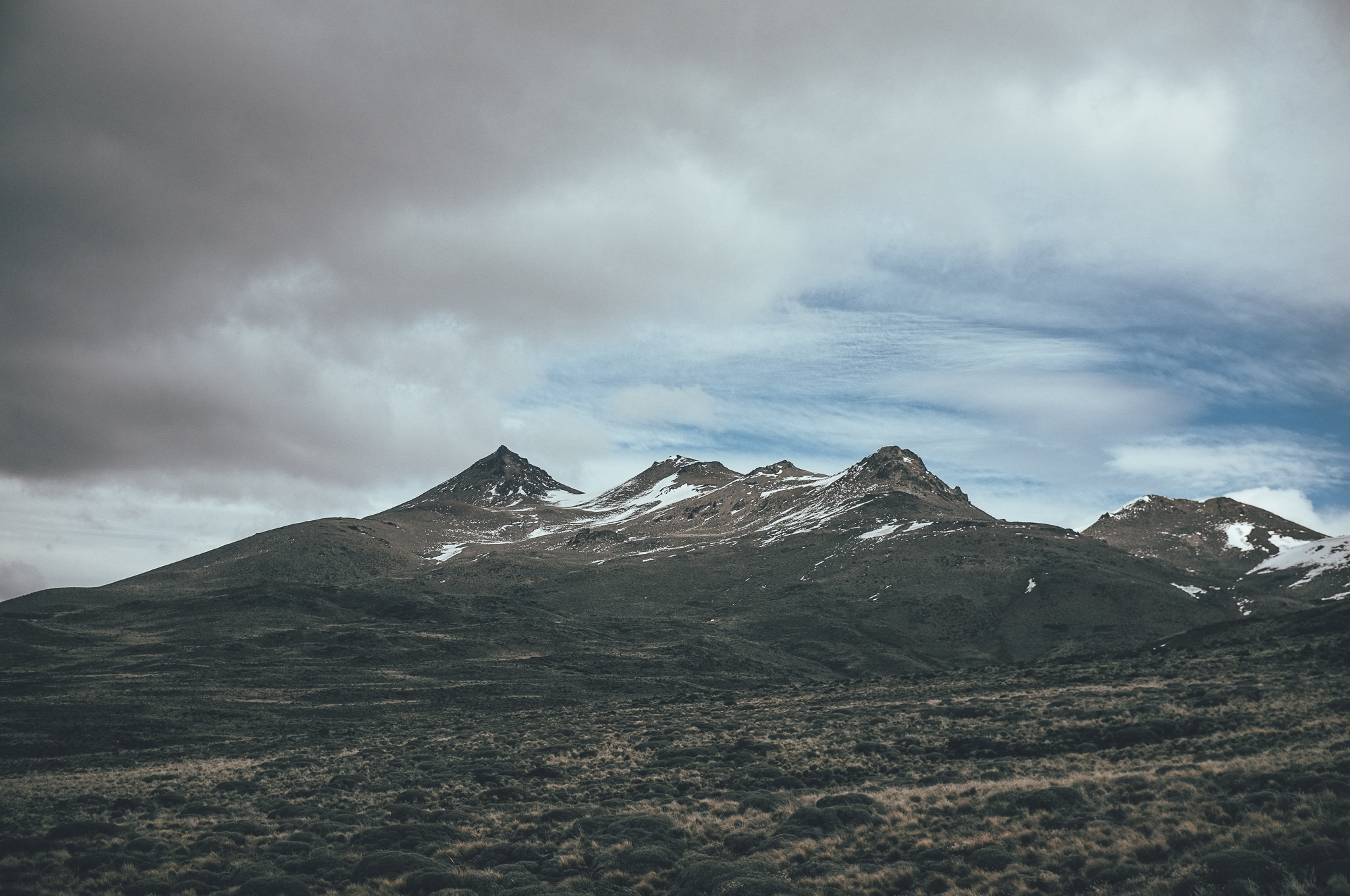
Trout stream and snowy peaks between the two higher passes.
I dragged my bike to the second 1480m pass on the soft double track enjoying the open views to the Cordillera de Los Andes on my left. Fresh footprints of a Puma reminded me that I was not the king of this land, even though I felt like one. Long downhills on the soft riding surface were fun and the kid inside me was jumping from a side of the double track to another and trying to make my bike drift in corners when ever possible.
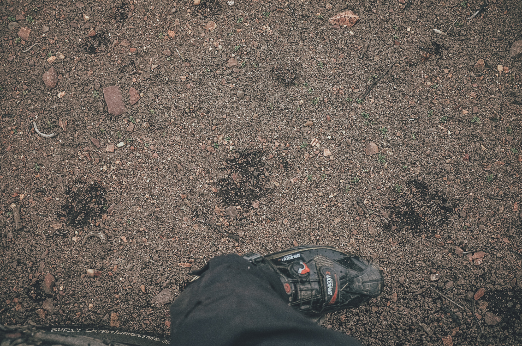
A proof that I was getting remote: footprints of a puma.
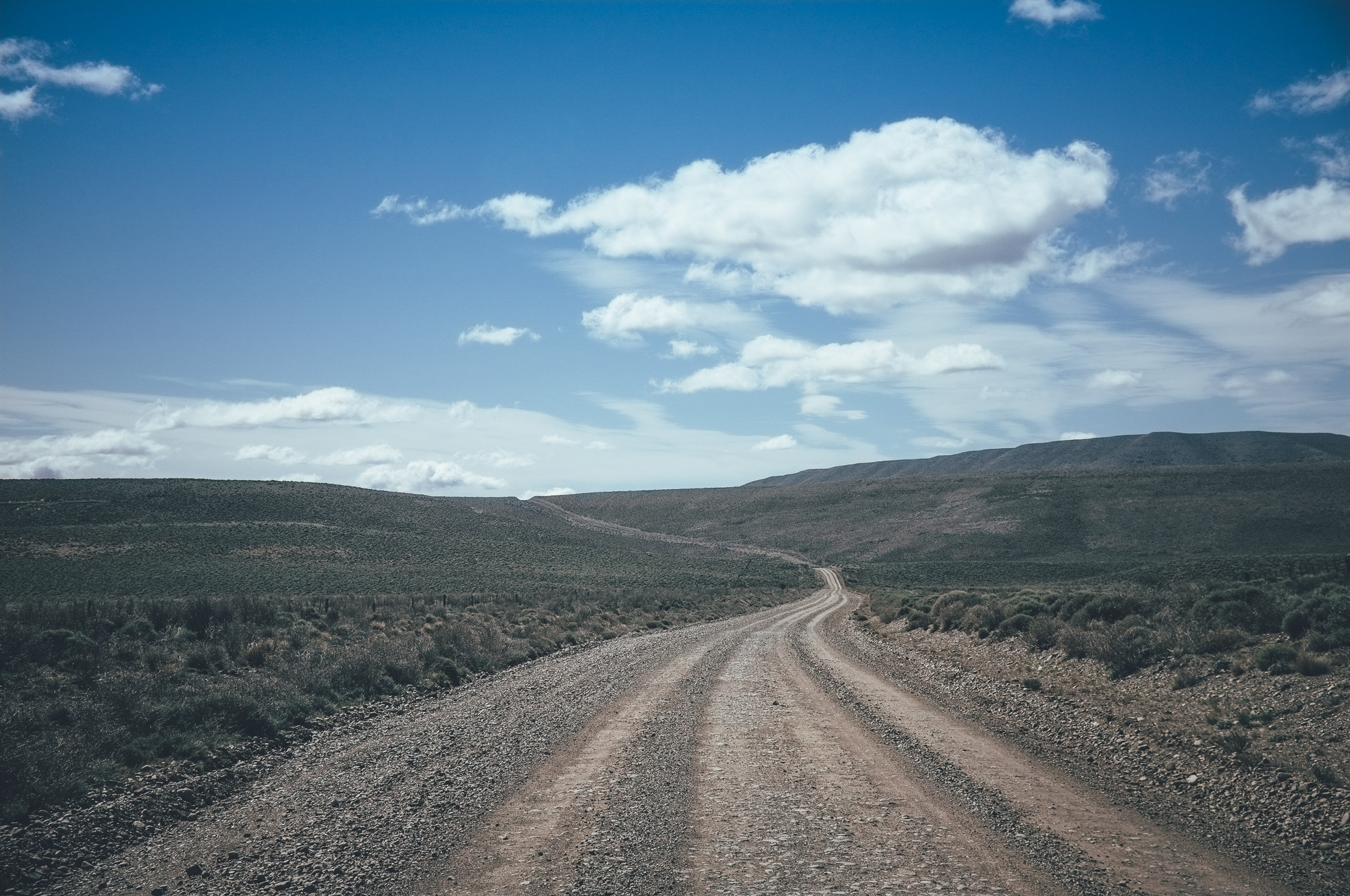
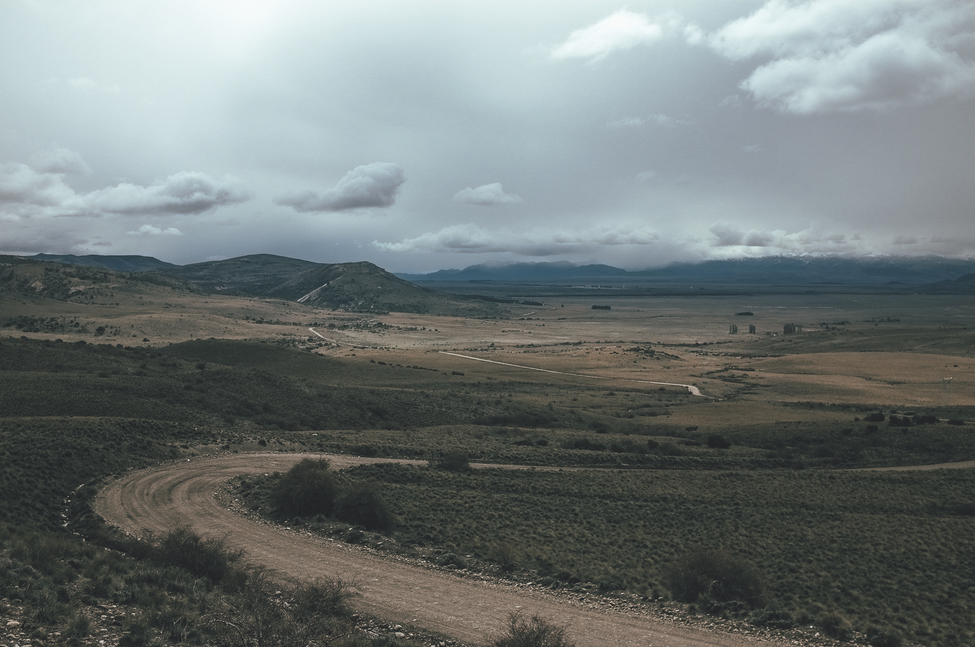
I had not been sure how much of a road there was, when I had been zooming in to the partly visible line in the steppe in satellite pictures back in El Bolson. The past two days had proved that the old road really existed and was mostly rideable as well. The two day section connected two remote roads visible on most of the maps, opening a new attractive route across the area. When I reached the more used road I was grinning widely for my discovery, knowing that there was nothing in front of me to spot me reaching San Carlos de Bariloche. I had not taking into account that my route would cross a couple of more rivers, however. The snow in the mountains was melting fast thanks to the longer days and higher rising sun and the melt water filled small rivers of the area to the brim. The first river crossing was knee deep, but the current slow. The second one looked much easier than the first one, being only 5m in width, but nearly got me off balance when I foolishly dragged my self straight into a deep part of the crossing. My feet were sliding on the pebbles in the storing current and only by lifting the bike my feet found grip on the river floor. The third river was much bigger than the first two ones, but it did not appear to be deep. Still crossing a 20m wide river alone in the early winter was not one of the must-dos on my bucket list. Sky was covered by clouds, which forecasted rain and/or snow.
20m does not sound like a long distance to walk, unless you are bear footed on river floor in ice cold water. Reaching the other side, my feet were numb and white. I quickly dried them as well as I could and wrapped them in thick merino wool socks. I walked up and down the river to warm my feet and to look for a nice campsite. Wind picking up I ended up pitching my tent behind a small empty fishing cabin.
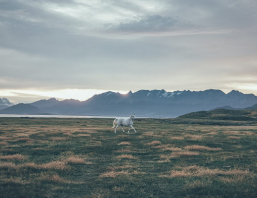
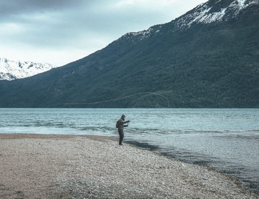
In the morning the sky was clear and the river inviting. This is Patagonia, there must be trout in the river. First cast, a couple of pulls in and I felt the first fish going for my pure white Woolly Bugger. Third cast and the same repeated. Ninth cast and I got the fish to my feet before some aerial acrobatics which gave the fish it’s freedom again. I sat on the river bank, smiling like a teenager after getting a phone number of an attractive counterpart. I had found a gold mine.
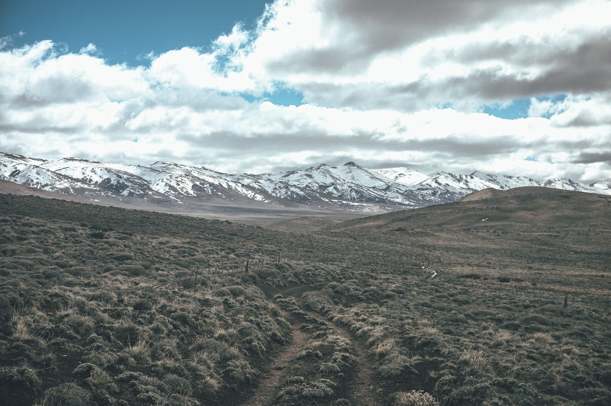
I fished the river inch my inch upstream and downstream from my camp, having the most eventful trout fishing I have ever had in my life. Under the sun the trout was careful though and I managed land only one for a quick photoshoot. I would have stayed at the river the whole day, unless the blue sky would not have turned into a grey one and light snowing had forced me to get on the bike to warm up.
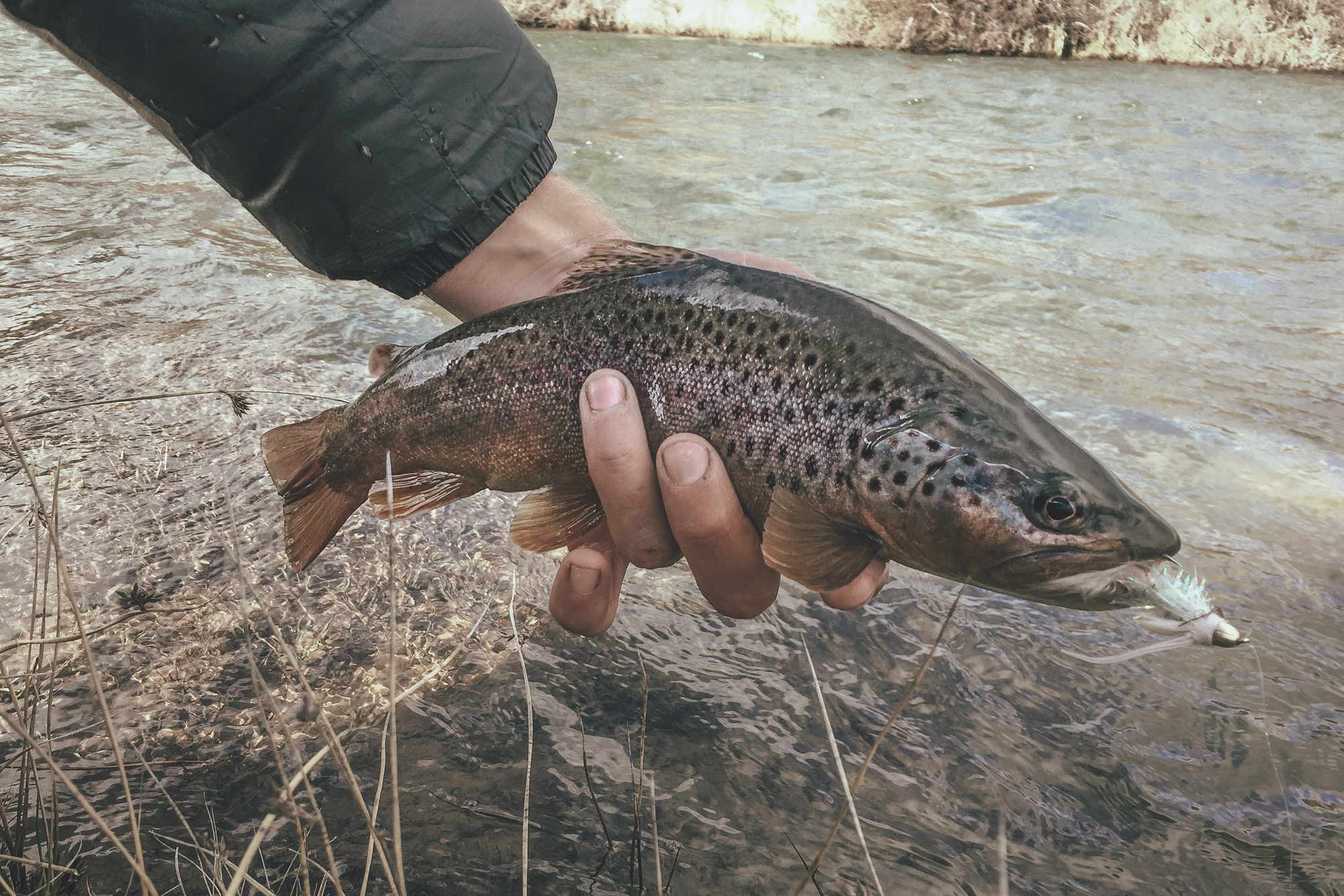
Open views and epic fishing on the way to Bariloche.
Bariloche was just a half a day riding distance from my previous camp and I reached the Casa de Ciclista Bariloche in the late afternoon. The smiling owner, Coco, warmly welcomed to his house, which he opened for touring cyclists in need of an affordable place to sleep already multiple years ago. Coco had a garage full of high quality tools, and during a couple of days rest I realized my dream to shave off the structurally less important parts of my well served, but heavy, Surly Nice Front Rack. Quick back-of-an-envelope calculations indicated that I could shave off quite a bit of weight by swapping from a 4-point attachment system to an improvised 3-point attachment system. I come out of Coco’s garage with a Surly Light front rack. The rack should be able to easily carry a weight of six kilograms, my current load in the front of the bike, but time would tell how the durability would be.
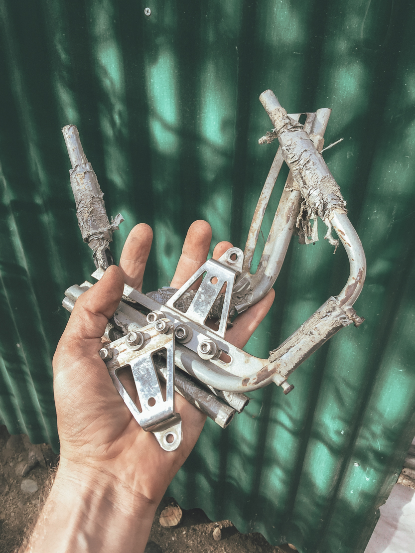
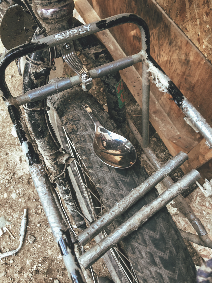
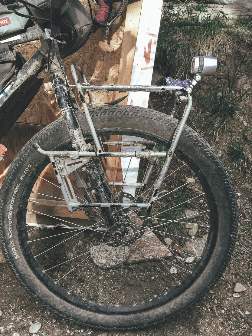
Surly Nice Front Rack on a diet.
Soft roads in the steppe had made me more tired what I first thought, and I eventually stayed at the Casa de Ciclista Bariloche a full week enjoying the views over the Lago Nahuel Huapi to the snow covered mountain range, socialising with other cyclists and finalising my first route for bikepacking.com, Fin del Mundo.
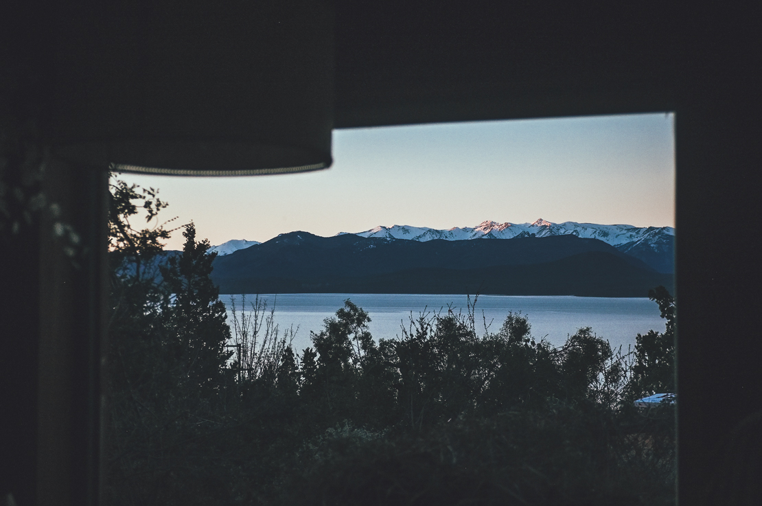
Lago Nahuel Huapi seen from the Casa de Ciclista de Bariloche.
The Route
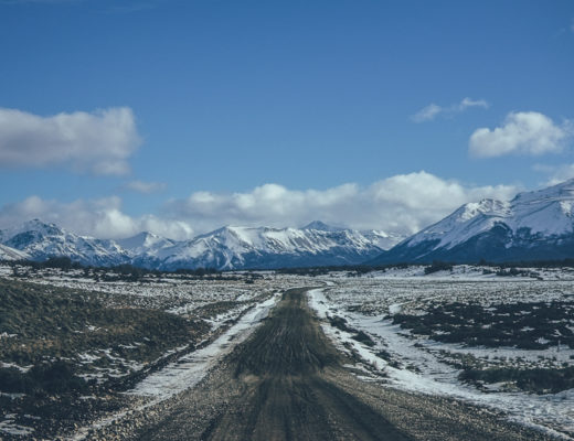
The route is mostly hard packed, but occasionally rocky gravel road. However the route over the two pass in the steppe could be very soft, especially early in the season and after rain. Plus tired recommended due to soft sections. The route is rideable only when the two 1480m passes in the steppe are free of snow, usually around from the early October to the end of May. Two river crossings (Rio Chico and Arroyo Pichileufú) at the steppe could be difficult to cross after heavy rain. Cars and trucks are likely to be able to cross after rain and give you a lift across, though traffic is rare.
The route ridden is part of the Patagonia Beer Trail, published on bikepacking.com on August 2018. The map of the whole route below: